NON-WADEABLE HABITAT SURVEYS
The Aquatic Inventories Program Non-wadeable surveys describe conditions in large, non-wadeable rivers to assess the potential of aquatic habitats to support salmonids and maintain ecological integrity. Our approach incorporates a unit-scale classification system (as introduced by Moore et al. in 2018), Side Imaging Sonar technology (pioneered by Kaiser and Litts in 2010), and Unmanned Aerial System (UAS) drone imagery. These three elements work to provide a broader view of aquatic ecosystems, allowing us to capture valuable data and gain insights that were previously difficult to obtain.
What sets us apart is our adaptability. We recognize that seasonal variations and habitat types demand different emphases. As such, we employ a flexible approach, adjusting the weight we place on each method based on the specific conditions and habitats under investigation. This ensures that our assessments are precise and tailored to the unique characteristics of the ecosystems we study.
Our commitment to merging tradition with innovation drives us to continuously refine and expand our methods, helping us better understand and conserve the rich aquatic environments that make Oregon's natural landscape special.
Project Contacts:
Matt Strickland
Eric Bailey
SURVEYING LARGE RIVERS
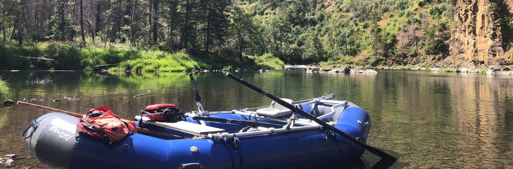
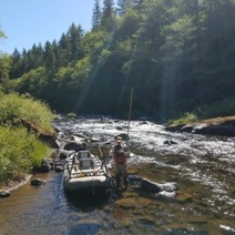
Boats are indispensable for surveying large rivers because they can cover large areas efficiently and safely. Their use is essential when river habitats are too extensive or deep to be adequately surveyed by wading. Boats allow our surveyors to navigate diverse environments, access deeper river sections, and study riverbank habitats. They provide a secure platform for equipment transport, enhance safety in challenging conditions, and expedite the survey process, making them a reliable tool for comprehensive data collection and informed ecosystem monitoring.
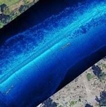
SIDE SCAN SONAR
Sonar technology allows us to access and map habitats previously deemed “too large” or inaccessible within the AQI wadeable protocol. Side Scan Sonar (SSS) can help reveal and characterize the underwater landscape in detail and overcome visual limitations such as turbidity, depth, and the overall scale of a river’s active channel profile.
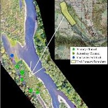
UAS DRONE
Using Unoccupied Aircraft Systems (UAS) opens up possibilities for surveying non-wadeable rivers and exploring fish-habitat relationships. At AQI, we use UAS drones to supplement our ground surveys and sonar data, unlocking a new dimension in investigating aquatic ecosystems.