Basin-Wide GIS Habitat Survey Datasets
Stream Reach Dataset Overview
ODFW AQI stream habitat methodology has been refined since its initial implementation in 1990, and our current methodology has been in place since 2016. If utilizing data earlier than 2016, please ask for a copy of the methodology that corresponds to that survey year. Our Stream Reach Dataset provides a comprehensive summary of habitat unit-level information, offering valuable insights into the conditions within a specific stretch or section of the stream. These broad-scale summaries serve as a valuable reference for future comparative research and the analysis of stream conditions.
An Oregon statute currently limits sharing location-specific information pertaining to threatened, endangered, and sensitive species. This applies to AQI GIS data from 2022 to the present. If you have questions, contact the AQI Program Leader for assistance.
To view a list of all the sites AQI has surveyed since 1990, follow this link: AQI Stream List.
Habitat Unit Data Repository
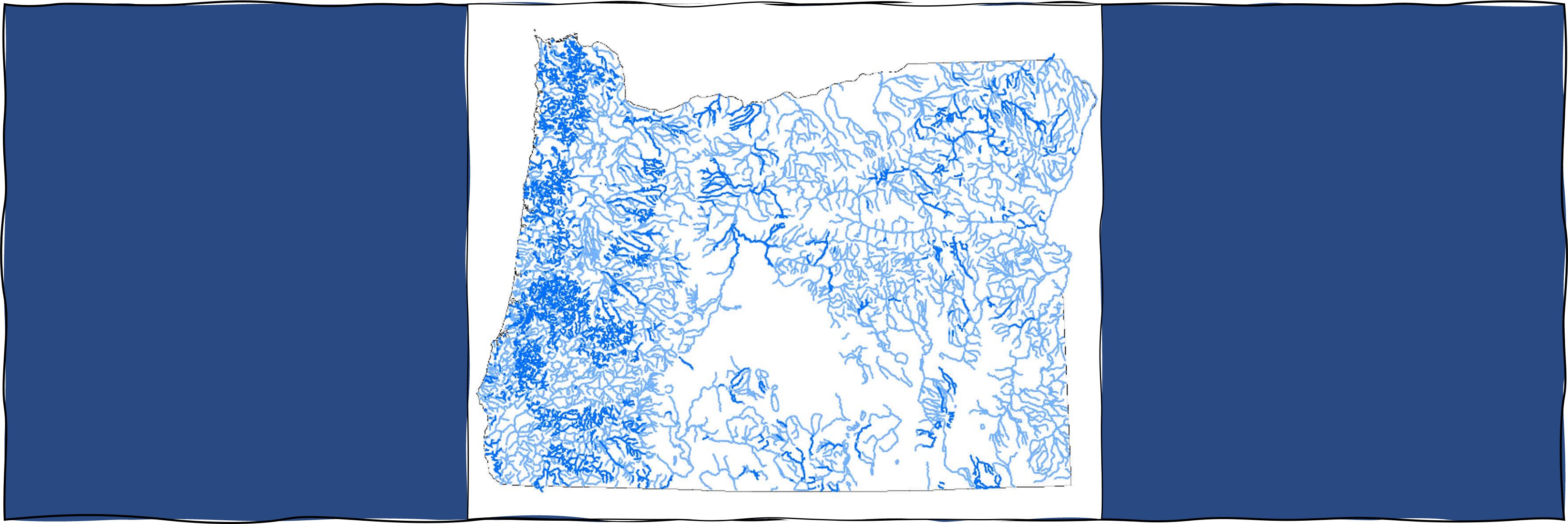
Within the Habitat Unit dataset, you will find a complete repository of unit data collected during our surveys. This dynamic dataset showcases noticeable annual changes in the distribution, size, and location of various habitat types. It's important to note that this dataset is not meant to serve as an absolute map of habitat distribution but instead offers a snapshot of the stream's condition at the time of the survey.
Accessing GIS Data 1:100000 scale
Broad-scale (Reach) and Habitat (Unit) data are available for streams surveyed from 1990-2017 as hydrology layers permit. To ensure easy accessibility for public and private organizations, we have integrated our data into an Oregon map based on 5th field Hydrologic Units (HUC'S). The target populations of streams are based upon a hydrography data layer developed by the USGS at the 1:100000 scale. This user-friendly interface lets you locate your area of interest (NW, SW, NE, SE) by clicking the corresponding links. Once selected, you'll seamlessly navigate to the specific region's 5th field HUC map.
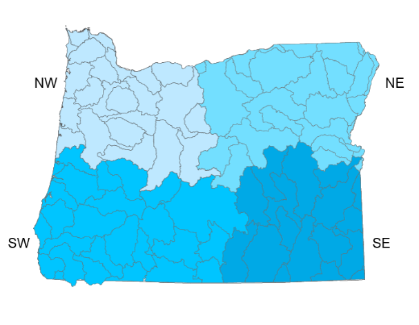
(NW) Northwest Oregon 1:100000 scale
(SW) Southwest Oregon 1:100000 scale
(NE) Northeast Oregon 1:100000 scale
(SE) Southeast Oregon 1:100000 scale
Accessing GIS Data 1:24000 scale
Broad-scale (Reach) are available for streams surveyed from 1990-2021 as hydrology layers permit. Habitat (Unit) level data are available for streams surveyed from 2018-2021. To ensure easy accessibility for public and private organizations, we have integrated our data into an Oregon map based on 5th field Hydrologic Units (HUC'S). The target populations of streams are based upon a hydrography data layer developed by the USGS at the 1:24000 scale. This user-friendly interface lets you locate your area of interest by clicking the corresponding links. Once selected, you'll seamlessly navigate to the specific region's 5th field HUC data.
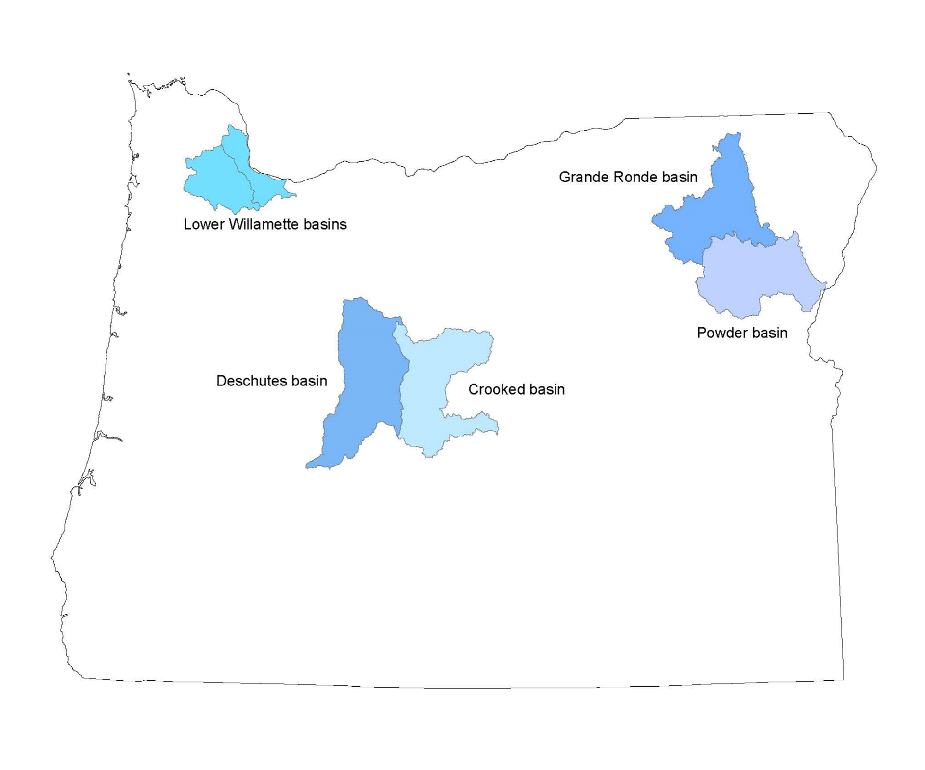
Each HUC link is associated with two zipped GIS shapefiles conveniently bundled for efficient transfer.
Reach Level Data 1:24000 scale
Basin-Wide Aquatic Habitat Surveys (1990-Present)
Unit Level Data 1:24000 scale
Crooked Basin 2019 (17070305)
Crooked Basin 2021 (17070305)
Deschutes Basin (17070301)
Grande Ronde Basin (17060104)
Lower Willamette Basins (17090010 & 17090012)
Powder Basin (17050203)